Sundowner, picnics, and braai spots
There are numerous vantage points on the higher ground and secluded pools on the river where a picnic or drinks-break seems an obvious choice. Provided that fires are only made in designated firepits, feel free to explore and discover your own unique stop-over. Over the past twenty years we’ve created several spots that we regard as being rather special. Here are some of them.
Postal Path Sundowners
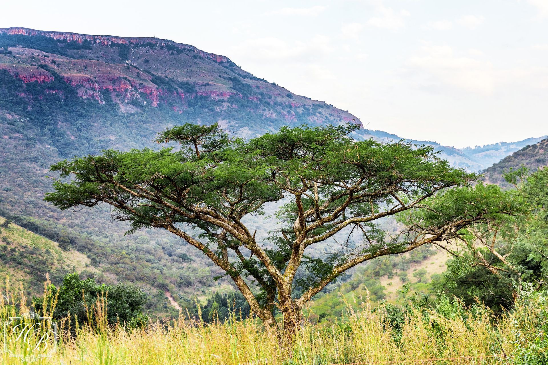
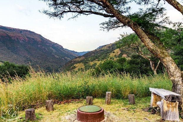
High on the western slopes of the cone shaped mountain 2,5 km behind the lodge, and some 250m higher, along the historical Postal Path (constructed by George Heys so that a donkey cart could drive from the family home (see the photos around the lodge) on the top of the escarpment to the post office at Waterval Onder, and more comprehensively described under the section on Heysbrook’s trails), is our favourite sundowner site.
While the spot is accessible by walking or cycling, if you intend taking a cooler box and/or food, you’ll need to use your vehicle. Requiring at least high ground clearance, and preferably four-wheel drive (Gerald will be able to advise if your vehicle is appropriate), this sundowner spot has a firepit, a flushing toilet with running water, and a wood burning braai (with a ready supply of firewood supplied). You’ll need to bring torches or rely on the fire for lighting after dark.
The vista over the valley looking down on the lodge - which looks tiny from this elevation - is washed with the setting sun. Pack a cooler box (using Heysbrook’ s plastic glassware), take a torch (you’ll invariably return after dark), and a jacket (it almost always gets cool enough to put it on) and perhaps ask Gerald to pack for a braai (using Heybrook’s melamine crockery).
Yes, it does require a little logistical planning (and getting the whole group together), but the end result is always worth the effort. Do remember your camera for some memorable painted skies (and the cell signal is usually good up there). It takes some fifteen or twenty minutes to drive up to the vantage point. Aim to get up there at least a short while before sunset.
Some video footage of this lovely Heysbrook location can be viewed on our website.
Bakoni Ruins vantage spot
With gorgeous views over the nearby Bakoni ruins up the valley to the red cliffs which define our boundary, this firepit is conveniently located for those not wanting to walk over uneven ground. Park your car on the road adjacent to the firepit, unpack your sundowners, light the fire, and soak up the evening ambiance that Heysbrook dishes up in abundance. From here there are established trails through a number of Bakoni settlements, culminating in the large kraal complex on top of the hill.

Oak Pool
Under a large, established oak tree on the banks of the Heys brook, accessible as either a short ten-minute walk from the Summerhouse, or by vehicle on the maintained track, this spot was supposedly established by George Heys himself, more than a hundred years ago as a picnic spot. Ideal (mostly for midday activities), this spot is synonymous with deep shade, the babbling brook, bird calls and butterflies. We strongly recommend a (plastic) glass of rosé, a good book and then an afternoon snooze, under the oak.
Walks, hikes, and trails
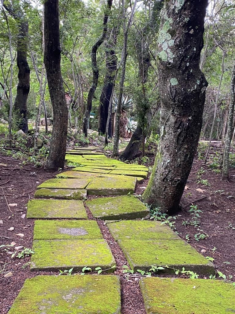
Heysbrook residents have exclusive use of the estate. There are numerous maintained trails - and many more to be forged - over the 1300ha estate. The estate is safe to explore on foot or bike, though the resident wildlife should please be given the respect they deserve. They are after all full-time residents.
Heysbrook is rich in its diverse fauna, flora, natural and human history. Numerous stone kraals of the Bakoni settlements established over the past several hundred years will be encountered on most walks. There’s a lot of Anglo-Boer War history in our valley with several block houses - used as vantage/signalling points during this war - explorable.
You’re welcome to bring your mountain bike. We routinely maintain some fifteen kilometres of trails in our valley. There are many more trails we have hiked, and which you are encouraged to explore, which are not maintained on a regular basis. While we have not specifically prepared any mountain bike trails, many of these hiking trails are suitable for advanced riders.
Some of our more organised trails include the following:
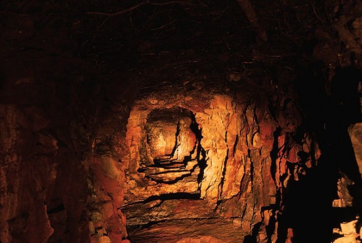
Pachner Gold mine walk
A moderately difficult walk, along the banks of Gold Nugget Creek (where several gold nuggets were originally panned) up to the historical Pachner Gold Mine, the last 150m section being nicknamed Thrombosis Hill, is well worth the effort.
This walk starts near the summerhouse and takes some two hours as a round trip (which ordinarily includes some time inside the several hundred metres of horizontal tunnels of the mine). The walk is suitable for anyone who’s reasonably fit or is prepared for the consequences the next day! We’ve been doing the Pachner Gold Mine walk regularly over the past twenty three years, originally with our children in baby-carrying backpacks. The oldest hiker, as far as we know, was deep into her seventy’s when she did the walk with us, conceded that she was ‘a little stiff’ the next day.
Under the shade of the riverine trees, most of the trail is along the banks of the creek. Notable sightings you will always see are the forest lavender trees (Heteropyxis Canescens), a rare species only found in Mpumalanga, and only occurring along the banks of streams in protected kloofs. Blood-orange tree trunks in early summer and leave tips which smell of lavender identify this tree.
Less often seen, though still a feature of this walk are the sightings (and sounds) of the narina trojan, a beautiful, elusive riverine bird, and the equally attractive purple crested turaco (previously a lourie). Other encounters have included bushbuck, baboons, porcupine, and bush-pig.
The last 150 metres to the mine is a safe steep climb up the steps cut into the hillside. The effort is worthwhile as you experience a century old mine hewn from the side of the mountain by hand. The gold bearing vein is apparent throughout the tunnels. Aside from some wet patches and a few bats the venture is safe and well worth the effort.
We know quite a bit about the mine itself, with lots of documentation being kept by the family of George Heys and made available to us. Never commercially viable, the mine’s gold bearing ore was never-the-less of high quality, with assayer’s reports recording visible gold in some samples. Pachner, one of George Heys’ farm managers at a time panned several gold nuggets here, and managed the operations at the mine, hence us naming the mine, and the creek after him.
After exploring the mine (and do remember to take torches and water bottles) you have the choice of returning down the creek or via a quicker route down the hillside above the trees.
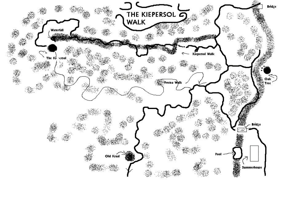
Biggest-kiepersol-in-the-world walk
More a climb in places than a walk, this delightful outing is under the thick forest canopy on the eastern slope of the Heysbrook valley. As the eastern slopes get more sun than the western side, the trees are generally bigger and the forest lavender on this route often exceed the dimensions ascribed to them by the book fundi’s. They’re not meant to get bigger than 5m, but try telling that to Heysbrook’s trees, which often exceed this size by some margin.
Following a small fast flowing spruit from the main road above the swimming pool (we usually drive to here from the lodge) for some forty-five minutes (and this depends entirely on how many times you stop to admire various vantage points along the route), you’ll arrive at a small sheer waterfall above which sits a very large kiepersol (Cussonia Spicata).
Without any empirical evidence, we ostentatiously named the walk ‘The biggest-kiepersol-in-the-world walk’ some twenty-five years ago. In the early 2000’s a group of members of the Dendrological Society of South Africa arrived requesting permission to measure the tree According to their measurements (and this was more than twenty years ago now), the tree then had a diameter of 1,9 m. To put this in context, each side of the square dining tables in the lodge are 0,9 m. If you put four of these together, the diameter of their combined 1,8 m is still shy of our tree’s width.
The girth is some six metres, which would not shame a baobab tree! It was confirmed by the Society after their visit that this was indeed the largest Cussonia spicata they had recorded in South Africa!
After reaching the kiepersol, you can either return back down the path you have just ascended, or head northward (down the valley towards the Elands River), along the contour until you meet up with the Protea Walk. A round trip of some two hours should be planned for. As already noted, you can walk from the lodge or drive the first kilometre or so in a vehicle, parking on the road where the trail joins it.
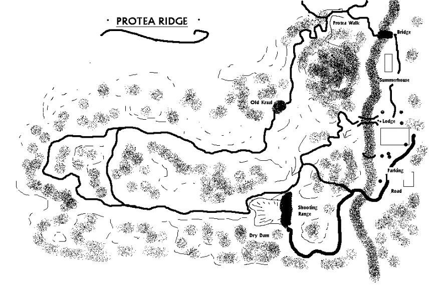
Protea Ridge Path
Usually ascended from the road past the Melrose Summerhouse (off a level clearing a few hundred metres above the bridge), the Protea Path is a walk taking you through the trees, around some old Bakoni ruins, ever climbing until you are some 150m above the height of the lodge, where after you follow the contour northwards. So-named because of the numerous protea bushes you’ll encounter along the walk, this walk is relatively easy once you’ve achieved the initial climb out of the valley. The walk ultimately arrives at the old dam site on the northern aspect of Heysbrook, where upon you’ll return along the road past the staff accommodation to the lodge. The round trip is again, some two hours. You should take water with you on this trail.
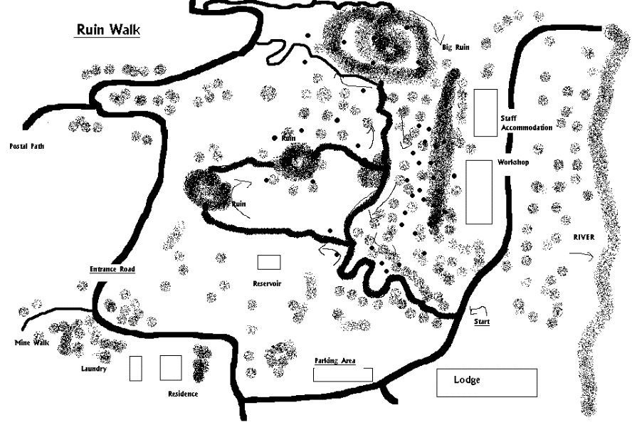
Bakoni Ruins Meander
A reasonably flat walk (and that is unusual by Heysbrook standards) and of particular interest to those curious about South African history, is the meander through the old Bakoni ruins on the western high ground above the lodge.
One leaves the lodge and follows the road past the manager’s house onto the plateau, on foot or by car. Near the Bokoni sundowner spot, there is a road to the ruins where some fifteen or twenty stone kraals are interlinked. These are the remains (many of them unbroken) of the tribe who occupied this valley hundreds of years ago. These were Iron Age residents and in addition to these grassland settlements, there is an iron smelter higher up the mountain (on the Kaalbooi trail).
We have found many artefacts in these ruins such as millstones, pottery fragments and gravesites. If you do come across any, please refrain from moving them. Please leave them for the next fortunate visitors to discover and experience.
One is immediately impressed by the sophistication of the settlements. Evidence of ducted water in stone-lined canals, contoured roads and demarcated cropping lands are still visible. See the write-up later in this booklet for more detail about the Bokoni settlements in Mpumalanga.
This relatively easy walk will take between two and three hours depending upon your historical bias. The historical ruins and the views over the lodge and up the valley make this walk very worthwhile.
Plattekop Climb
The climb to the highest point of the estate, being Plattekop mountain, is on the eastern boundary. At 2 090 m, it is nearly 800 m higher than the lodge. It is often misty and cold up here whereas the lodge itself may be experiencing very different weather. This round trip of some four hours is for the fit only. There is no water source on this trip, and it is therefore important to take sufficient water bottles with you.
After leaving the Protea Path Meander there is no defined trail. A British block house on the ridge, about half-way to the top is worth exploring. We’ve found (and left there) various artifacts including bullet cartridges and a harmonica. Not visible from the lodge is a large saddle of open and flat grassland which often hosts a herd of impala and other antelope. We never see these impala lower down in our valley.
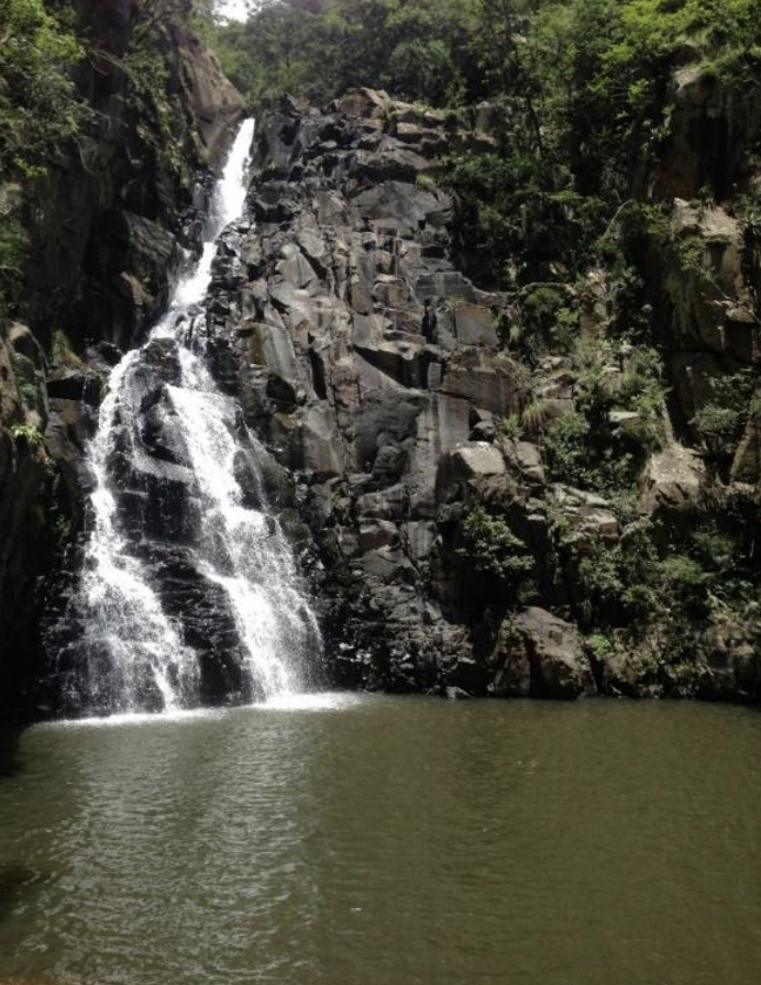
Postal Path to the Pacher falls on Kaalbooi
The climb to the highest point on the western side (the range behind the lodge, named Kaalbooi, as about 70m lower than Plattekop on the eastern side ) is surprisingly attainable if one drives the first section to the Postal Path sundowner spot. The trail is so named after George Heys created this trail 100 years ago so that his staff could travel from his farm house on Tudor Estates above the Squareface waterfalls on the Heys Brook, with a horse or donkey cart to collect the mail from Waterval Onder.
Three or four hours should accommodate the round trip. On the top, you’ll be standing on the edge of some 70m sheer cliffs overlooking a waterfall on the Pachner stream, looking down on the lodge. Klipspringers (which we only find here) and a resident troop of baboons are often seen on this outing.
Squareface Falls
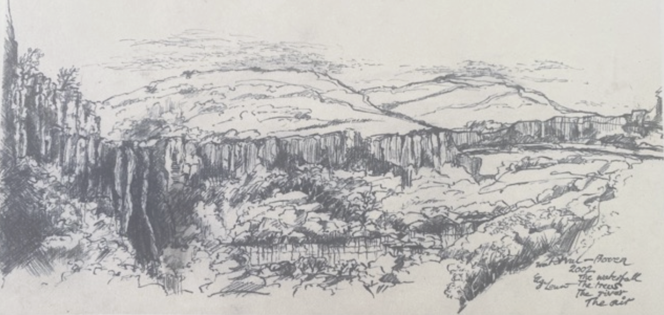
Heysbrook’s ultimate expedition (and it is more than just a hike) is along and through the river to the Squareface waterfall at the end of the property, where the river completes its 800m descent off the highveld, in a series of waterfalls.
A round trip of ten to twelve hours - a full day - should be anticipated, with an understanding that the approximately 15 km requires an hour for each hard-won kilometre. There are lots of pools and small waterfalls, many of which you’ll need to traverse. Be prepared to get wet. Please don’t do this outing alone as the gorge becomes very isolated, and there’s no cell signal at all.
You’ll need to be properly fit to enjoy this full-day outing. You will know when you’re halfway - recognising that you still have to turn around and return downstream back to the lodge - when you reach the base of the waterfall which spills into a large, Olympic swimming-pool sized square faced pool. If you’re able to dive to the bottom of the pool, please let us know. None of us can and no-one has yet reported that they have achieved it - yet.
You’ll be more than entitled to have your drinks served to you by the rest of your party once you return from outing. Indeed, you may have a physical requirement for this attention…
Fascinating history close by
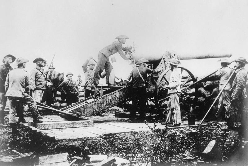
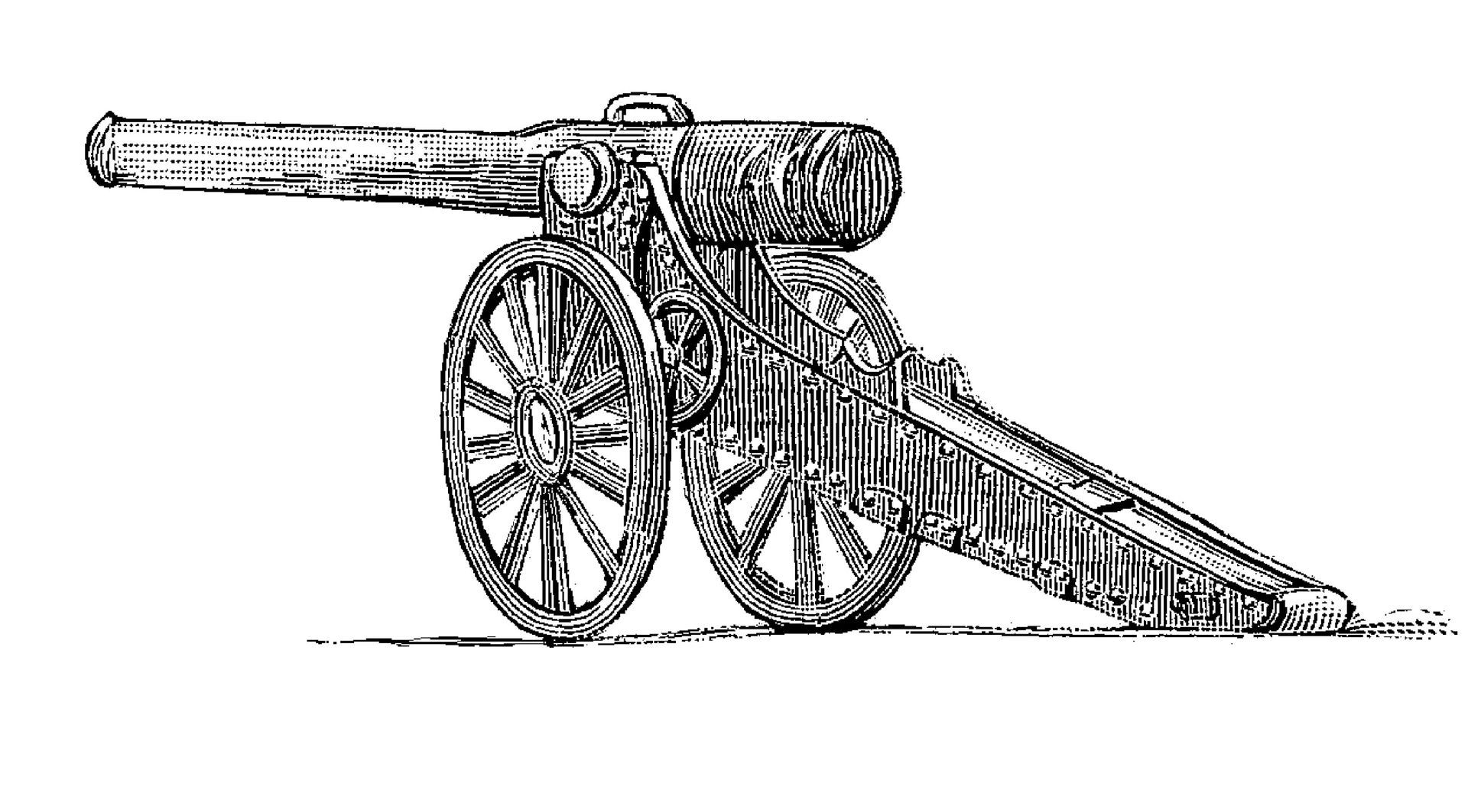
Looking for the last Long Tom Cannon
The South African Defence Force spent some considerable time and money in the 1990’s searching on Heysbrook’s escarpment between Squareface Falls and Feathery Falls (have a look at the 100-year-old photos of these in the main lodge bar), on the southern boundary of Heysbrook for the last missing Long Tom Cannon.
The basis for the search was founded on two Anglo-Boer war diary accounts of British soldiers who were pursuing a Boer Commando on the ridge and witnessed the commando pushing the cannon over the precipice rather than have it captured. Additional support for this thinking was based upon the diary account of a Heysbrook visitor who was hunting in the Heysbrook valley in the 1960’s and writes about standing on the ‘barrel of a cannon’.
First-hand oral accounts in 1999 from Ben, then an old, retired farm labourer of George Heys, tell of him, as a young child minding sheep, looking down from the top of the waterfall upon a large “steel pipe and wheel” in the river.
Some historians would have us believe that all Long Tom’s have been accounted for, though this is not without dispute. Though we may be biased, we’re certain there is an important Anglo Boer relic somewhere close to the waterfall awaiting some guests’ find. As with all other artifacts, we’d prefer if you leave this where you find it, and not take it home.
Historical buildings and structures within a few minutes’ drive of Heysbrook include:
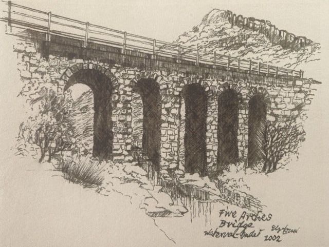
The Five Arch Bridge
The Five Arch Bridge near the NZASM tunnel, a declared national monument, built with dressed Italian stone in 1894.
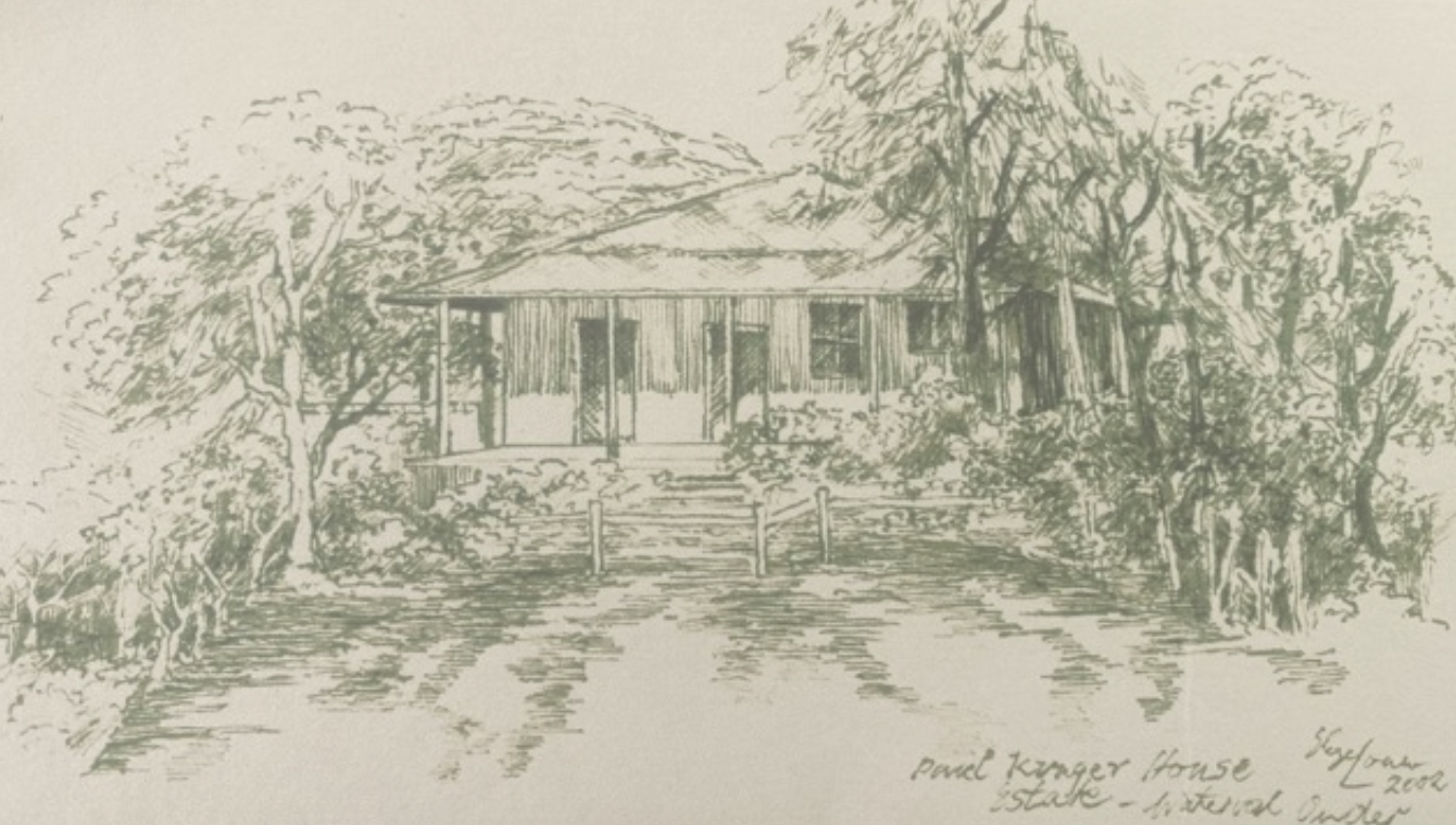
Krugerhof
Krugerhof Museum, adjacent to the Tickled Trout and the Wayside Lodge. In addition to being an important railway junction during the Anglo-Boer War, Waterval Onder has a special place in South African history as the last home to President Paul Kruger for some three months towards the end of the Anglo-Boer war, from where he left for Delagoa Bay en route to Europe where he died in exile in Clarence in Switzerland.
Kruger had been based in his official railway carriage suite and offices at Waterval Boven and suffering from the cold decided to move down to Waterval Onder where he took up residence in an annexe of the Wayside Inn hotel. These rooms (uniquely without any internal doors) have been converted into a mini museum with a very interesting pictorial history of “Oom Paul” and South Africa through these formative times.
Krugerhof is well worth forty five minutes of your time and unlike just about everything else in life, the experience is free!
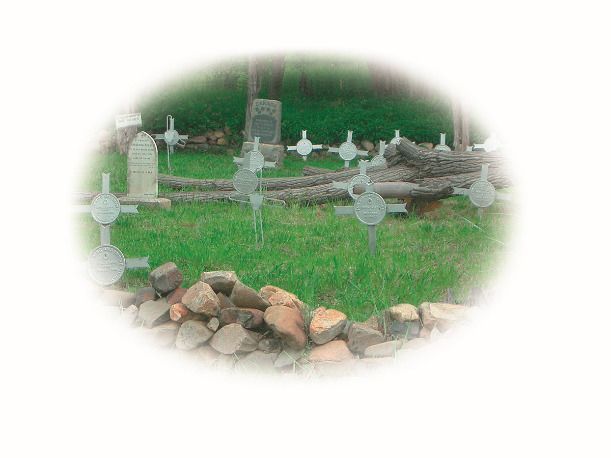
Ghosts and cemeteries
Guests can enjoy visits to several of the Anglo-Boer cemeteries in the valley. There are several local guides advertising their services for this outing.
A turn-of-the-century graveyard, including the British cemetery from the Anglo-Boer War, is situated a short walk away from Krugerhof, a few hundred meters from the entrance to Heysbrook. We’ve undertaken many an after-dinner visit to the military cemetery, where we have toasted the ghost of Lieutenant Lawler - the only officer buried here - and always a key character in South Africa’s best known ghost stories.
In this graveyard are some sixty civilian graves, most from the turn-of-the-previous-century. Of particular importance perhaps, certainly to those historically inclined, are the thirty nine British and Commonwealth soldiers buried under their iron crosses “for King and Empire”.
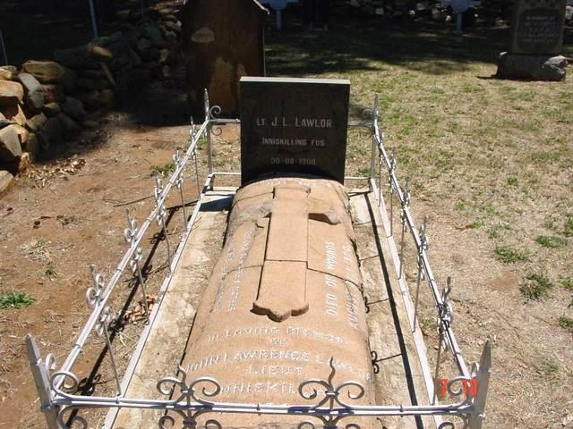
The tale of the soldier and the nurse is worth the telling…
Read any book about famous South African ghost stories, and you’ll almost certainly come across the story of the British soldier and the Afrikaans nurse killed in an Anglo-Boer skirmish in Waterval Onder in 1900.
The story goes that Lt Lawlor, wounded in a skirmish in the town, was recovering in the hospital in Waterval Onder, attended by an Afrikaans nurse (Waterval Onder having been under both Boer and then British control), with whom he fell in love. In a subsequent attack, as the British took back the town, both Lawler and the Nurse perished. Their ghostly apparitions have repeatedly been seen meeting at a peppercorn tree in Waterval Onder, near the (now defunct) Wayside Inn.
A particularly detailed account is documented by two families picnicking in the grounds of the hotel at Christmas in 1962. One father recounts the children reporting seeing the figures of a soldier and a nurse. When the two fathers followed the children, they saw the clear apparitions of the two figures gradually fade away under the peppercorn tree. However, sometime after that, the tree was blown over in a severe storm and no sightings have been reported since. Yet.
Lt John Lawlor is buried at Waterval Onder where his grave can still be visited. Sadly we have no credible history of the nurse. In any event, we’ve thought it appropriate to recognise this bit of Africana in the naming of room’s 7 and 8 at the lodge.
Things to do outside of the estate
Many of the Mpumalanga tourist highlights, including the Panorama Route, are within a comfortable day trip of Heysbrook. A day outing could include a number of the following: Pilgrims Rest, Bourke’s Luck Potholes, the Long Tom Pass, Kaapsehoop, Barberton, Sudwala Caves, the Berlin Falls and the Bridle-veil Falls. A guided tour of Berg-en-dal, where the heaviest artillery bombardment of the Anglo--Boer War took place too can be scheduled.
Some outings which we’ve done several times and which we specifically recommend include:
Coffee and curios in Dullstroom
Dullstroom is some 50 km away. A tourist town with numerous coffee shops, restaurants, art galleries and antique shops is also close to the golf course at Highland Gate.
Other tourist towns within a day’s return trip from Heysbrook
Graskop (160 km), Sabie (130 km), Pilgrims Rest (137 km), Bourke’s Luck Potholes (187 km), White River (96 km) and a number of other tourist towns are within easy reach.
Kaapsehoop
Kaapsehoop is famous for its wild horses which roam freely around the village, descended from the left-behind horses of the silver and tin miners of the late 1800’s, various B&B’s, wedding venues and artist studios. We can recommend this pretty 50km drive from Heysbrook culminating in a pancake lunch at one of several restaurants in the village. It’s also en route to Mbombela (Nelspruit) if you’re going this way. Stone Circle Tours, run by Michael Tellinger can take you on his own version of the Bakoni ruins and/or Adams Calendar (near Kaapsehoop), purportedly the oldest man-made structure on earth.
Sudwala Caves
Well worth the 60km journey, a guided tour of the caves and a meal at one of the restaurants makes for a pleasant day out, particularly with children.
A day through Swaziland
A two hour drive via the Swaziland Oshoek border from Heysbrook brings you to the Royal Swazi Spa. A further one and a half hours (perhaps after a late breakfast) takes you past Piggs Peak to the Josefsdal/Bulembu border post, whereafter a meandering drive over the spectacular pass via Barberton and Kaapsehoop takes up another 2 hours before you return to Heysbrook. We’ve done this a few times and haven’t tired of it yet. Do remember your passport.
Golf
A number of quality golf courses are within reach of Heysbrook. These include Highland Gate in Dullstroom (55 km), Drakenzicht Mountain Links (50 km) in the Schoemanskloof, Mbombela Golf Club (previously Nelspruit Golf Club, 82 km), White River Country Club (104 km), Sabie River Country Club (147 km) in Hazyview, Leopard Creek (148 km) and Malelane Country Club (143 km).
Graskop Gorge Lift
The viewing lift takes visitors 51 metres down the face of the gorge into the forest below, where wooden walkways & suspension bridges meander along a 600-metre trail through the indigenous forest with interactive exhibits. Contact 066 305 1572 for details and pricing.
Long Tom Toboggan Run at Misty Mountain
Reaching speeds of 45 km/h over the 1,7 km run, over its three minutes of travel, you can get more information and book your ride on 013 764 3377.
Mountain Strings Zipline
Immediately next door to Heysbrook is the 2021 constructed 1,7km zip line. Seven lines totalling 212m in elevation takes some two or three hours. Open all week except Mondays, contact 076 030 2097 for details and bookings.
Though sadly it’s deteriorated over the years (as have many rural towns), Waterval Boven still has a number of turn-of-the-century buildings in Waterval Boven, also built with imported dressed stone.
Waterval Boven is a world-renowned mountain climbing area, attracting international climbers.
Enjoy your stay!
Let us know if we can help you with booking enquiries, personal request or any further information.
Looking forward to hearing from you!
